Traceability, ESG & Carbon Intelligence for Global Trade

Orbit: Field Scout for Farming

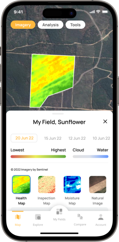
Orbit is a field scouting app that offers real-time crop monitoring through satellite-based remote sensing. With an easy-to-use interface, remote crop monitoring tools, 24/7 expert support, and advanced NDVI technology, Orbit enables you to manage risks and optimize production in your field. Stay informed with Orbit’s crop health information and field monitoring system to make data-driven decisions. Start using crop monitoring technology for field scouting and maximize your yield!

WHY YOU CHOOSE?
Keep an Eye on Your Field with Orbit’s Crop Monitoring Satellite Service

Monitor Your Crops Remotely

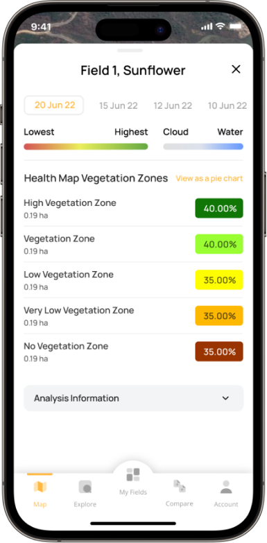
Orbit is a digital field scout that leverages daily satellite imagery for crop monitoring, enabling early detection of problematic areas and low-performance zones. Our remote sensing-based technology tracks vegetation changes to identify nutrition deficiencies, crop damage, and irrigation congestion.

Compare Yield Potential with Neighbors

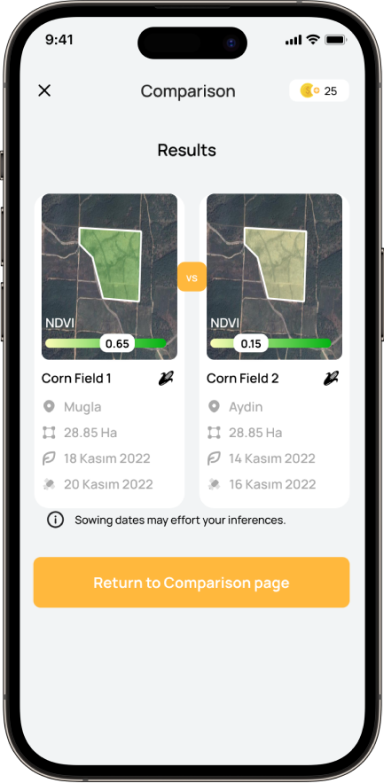
Orbit allows you to monitor crop health and development in real time and compare it to neighboring fields. By analyzing average NDVI values, you can gain insights into the yield potential of each area.

Get Irrigation Advice

Thanks to its smart crop monitoring capability, Orbit provides a Plant Water Stress Map of your fields and recommends the next best irrigation date by calculating daily crop water loss due to perspiration.

Prevent Minor Issues From Becoming Major Ones

Receive hourly and daily updates about weather conditions specific to your location with Orbit’s remote-sensing crop monitoring system. Benefit from live rain and storm tracking maps and receive push notifications about potential fungal disease risks and other climatic changes that may impact your crops.

Stay Organized with Scouting Notes

Efficiently manage tasks with Scouting Notes, both in and out of the field. Mark problematic areas on the map and add notes, photos, or tags to record observations. If an anomaly is detected, you can mark it and set reminders to check on it later. Stay informed about your crop health and protection with Orbit!

Variable Rate Application

Variable Rate Application integration utilizes satellite imagery crop monitoring to analyze field variability and create a map that divides the field into zones based on soil type, topography, and yield potential. This allows for different rates of agricultural inputs to be applied to each zone based on their specific needs, optimizing input use, reducing costs, and improving yields.

24/7 Expert Agronomist Support

Orbit provides 24/7 access to Dibiz-Rexil’s team of expert agronomists for technical and agricultural support.

SERVICES

 
Free
Always
Pro
1-3-6 Months Subscriptions
 
 
High Resolution Satellite Imagery ✓ ✓  
Image Frequency per Month 6+ Not-Required  
Health Map ✓ 5 MP  
NDVI Zone Distribution High High  
Automated Problematic Zone Detection & Warnings – ✓  
Inspection Map ✓ ✓  
Plant Water Stress Map ✓ ✓  
Customized Irrigation Recommendations ✓ ✓  
Variable Rate Fertilization ✓ ✓  
Irtem Integration  ✓ ✓  
Yield Potential Comparison – ✓  
Scouting Notes ✓ ✓  
Hourly & Daily Weather Forecasts ✓ ✓  
Live Rain & Storm Tracking ✓ ✓  
Suitable Spraying Hours ✓ ✓  
24/7 Expert Agronomist Support – ✓    

DIBIZ-REXIL IN NUMBERS

Only numbers can describe us the best. Therefore, we summarize our team, competences and numbers we reached since our foundation.